

TeamTracker™
Cover it once. Cover it well.
TeamTracker supporting bomb debris cleanup on a former military base in Hawaii.
Applications
-
UXO - Unexploded Ordnance
TeamTracker tracks coverage of removal of unexploded ordnance (UXO), a critical defense and environmental need on formerly used defense sites (FUDS) and active target ranges. Greatly reduces data quality issues and rework cost on UXO projects.

-
Evidence Collection
TeamTracker is ideal for law enforcement and private evidence gathering investigations. Quickly set up, mark points, and add photos to points of interest. Ideal for Type III criminal evidence searches.

-
Bio / Environmental Survey
TeamTracker can be used for species surveys, environmental and radiological studies, wetland studies, in addition to agricultural and forestry applications. TeamTracker supports pre-loading expected species datasets for rapid tabulation.

-
Search & Rescue
When time is ticking and accuracy is critical, TeamTracker can be used for rapid-response search and rescue operations, including remote locations lacking cell coverage. Remote monitoring allows the search to be overseen and directed in realtime.

-
Facility Inspections
Efficiently gather inspection data on every inch of critical industrial facilities and infrastructure. Enable fast, detailed inspections that establish clear records for maintenance and compliance, and even for insurance needs and emergency repairs.

-
Archeological Survey
Proceed quickly and cautiously gathering archeological data in stackable layers that can be combined to derive insight into the buried and unseen. Easily pin and collect points of interest as the past reveals itself.


Benefits
-
TeamTracker is so easy to use that field personnel can be trained in minutes. The GUI has been specifically designed to be usable by all field personnel, regardless of technical background.
-
TeamTracker eliminates wasted time messing with equipment. Automatic equipment functionality and RTK precision check-ins get you working fast each morning. We've designed in compatibility with high-capacity batteries available at any hardware store. Easily re-configure GPS units and team members to offset any hardware issues.
-
Collect 3cm precision GPS data for an entire team of up to seven "sweepers" and one team leader. Quickly add detailed points of interest including photos and predefined or custom information.
-
TeamTracker is the best available tool to prove you met or exceed regulatory or industry standards, including coverage, overlap, velocity, POI data formats, and many others.
As just one example, TeamTracker helps meet the stringent Army Corps of Engineers standards for UXO remediation in EM 200-1-15.
-
Eliminate costly re-work that is often identified days or weeks after a geospatial dataset is analyzed. With TeamTracker you know immediately when a data quality issue arises and can fix it in minutes.
-
What you're looking for is important. TeamTracker is streamlined to keep you focused on your objectives through our strait forward hardware and streamlined UI/UX. Audible quality alerts allow the team leader to continue working even when the screen is off.
-
Export in widely available formats, including .kml files easily importable into other programs including Google Earth.
-
Generate detailed reports that show what you covered, plots POIs, and displays the data quality standards you met or exceeded.
How it works:
-

Deploy in Minutes in Any Location
Rapidly configure teams of up to 8 personnel. Automatically generates equipment and geospatial check-in reports. Deploys to any location through StarLink® option.
-
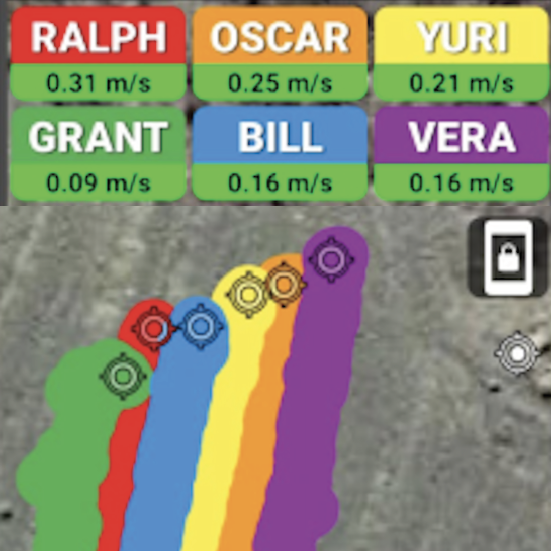
Collect High-Precision Tracks
Each TeamTracker kit records up to 7 simultaneous data streams at 3cm accuracy. Rove 200m from a central team leader, or from kilometers away with ad-hoc network option.
-

Rapidly Define Points-of-Interest
TeamTracker’s streamlined UI enables personnel to create detailed points-of-interest (POI) in seconds, including photos. Supports custom pre-loadable POI datasets.
-

Assess Coverage Quality in Real Time
View coverage tracks in real time to eliminate gaps and re-work. Receive instant coverage quality alerts including velocity, overlap, GPS precision, and other metrics.
-

One-Click Coverage Reports
Generate simple, clear reports that show who covered what, at what time, and to what extent. Helps you to easily prove you did your job to the required standards.
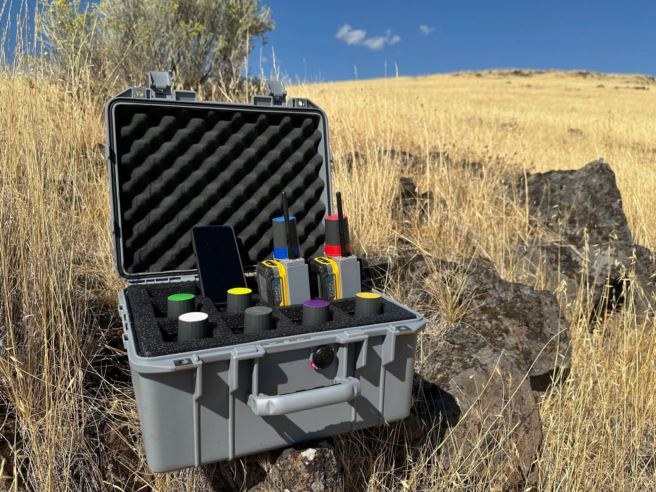
TeamTracker™ Geospatial Systems
-
Accuracy: 3cm RTK GPS | 1m DGPS
Unit weight: 1lb
7 rover units and one base station
Range from base: (i) >1mi with internal license free 900 mhz radio, or (ii) up to 15mi using Cellular data or repeaters.
Battery: 12+ Hour battery life using DeWalt® Powerstack
-
Custom number of collection units or team leader devices
Starlink® for remote locations
Remote project monitoring
-
Included training materials and documentation
Standard support package included, including rush equipment replacement
Optional 24/7 Support Packages